HEALD GREEN, STOCKPORT

Shaping a landscape led masterplan and design code for a around 650 homes with extra care facilities and a new Local Centre.
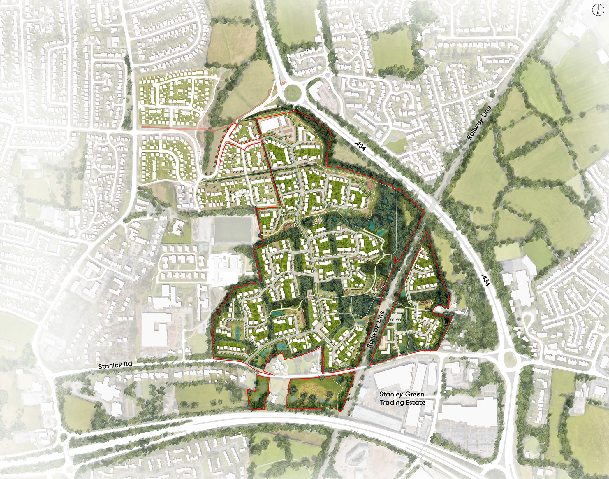
A detailed map of a residential development area with streets, green spaces, and buildings, including labeled roads such as Stanley Road and the A34, and a marked estate area called Stanley Green Trading Estate.

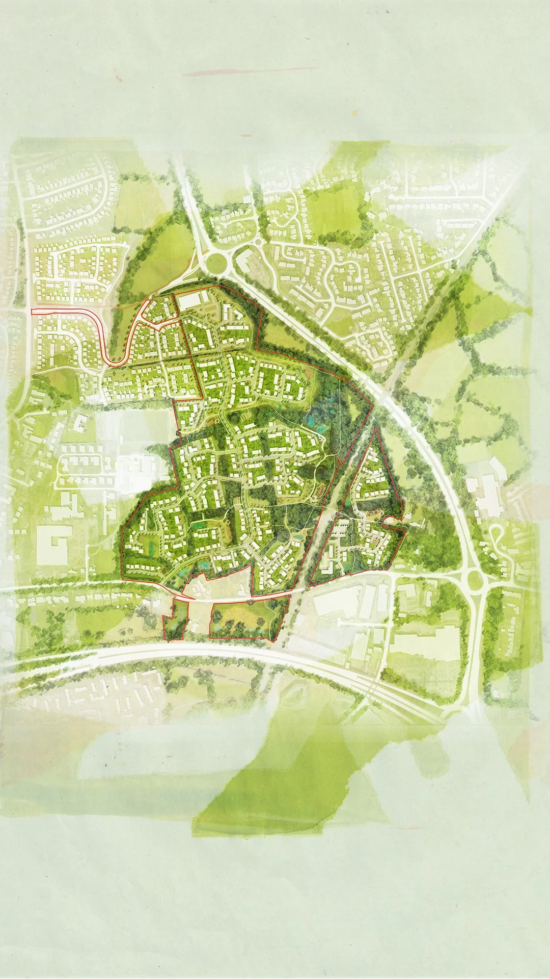
Illustrative Masterplan for the Heald Green development

Heald Green presents an opportunity to deliver a landscape led sustainable new residential community and local centre in Stockport. We were asked to prepare a considered and responsive masterplan that worked with the landscape, accommodating a varied mix of 675 new homes, Extra Care facilities and a new Local Centre.  
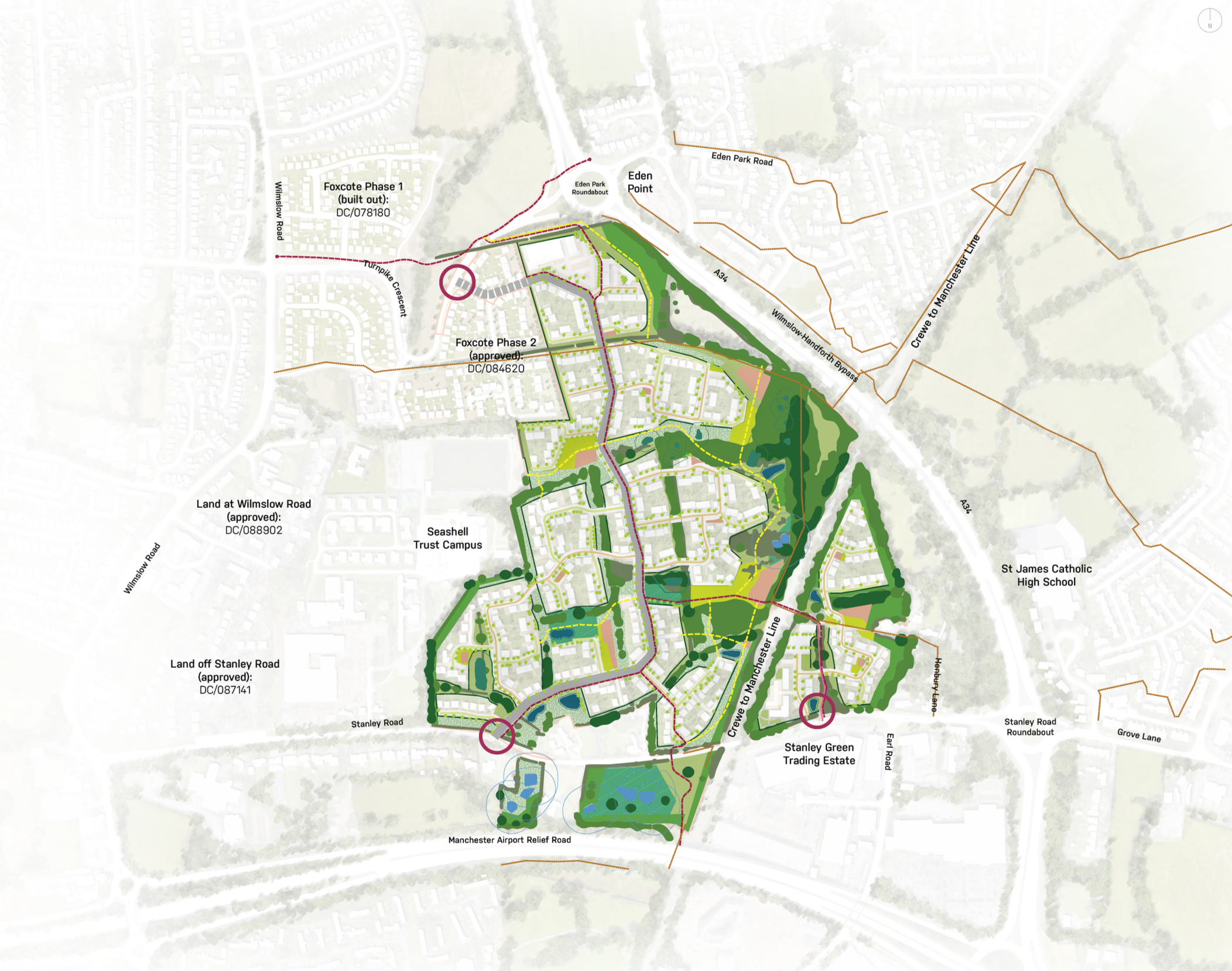
A detailed urban planning map showing various development phases, roads, green spaces, water features, and specific landmarks, including schools, roads, and a campus.

Landscape Structure

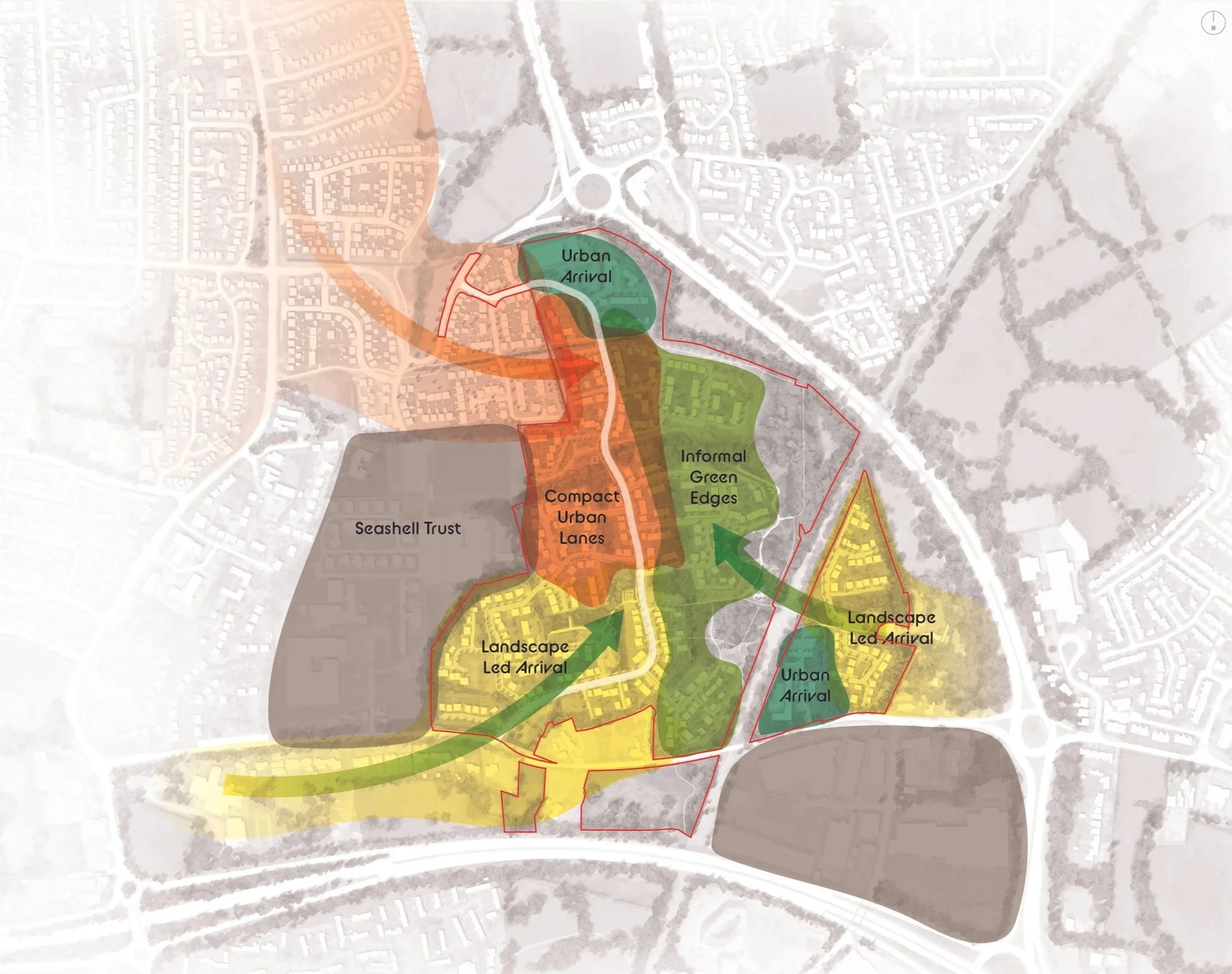
A map with various colored zones labeled 'Urban Arrival,' 'Informal Green Edges,' 'Landscape Led Arrival,' and 'Seashell Trust,' showing different urban planning or development areas overlaid on an aerial view of a neighborhood.

Character Areas and influences with the masterplan

Design Code

To support the Masterplan, we were also asked to set out a visual Design Code that set clear principles around how the form, character and layout of spaces across the Masterplan could combine to create clear character areas and responses to existing landscape principles. 

The Design Code established character areas, built form principles, materiality and street typologies. It set out where areas of Code Control should be applied, ensuring consistency across the Masterplan and its environments.
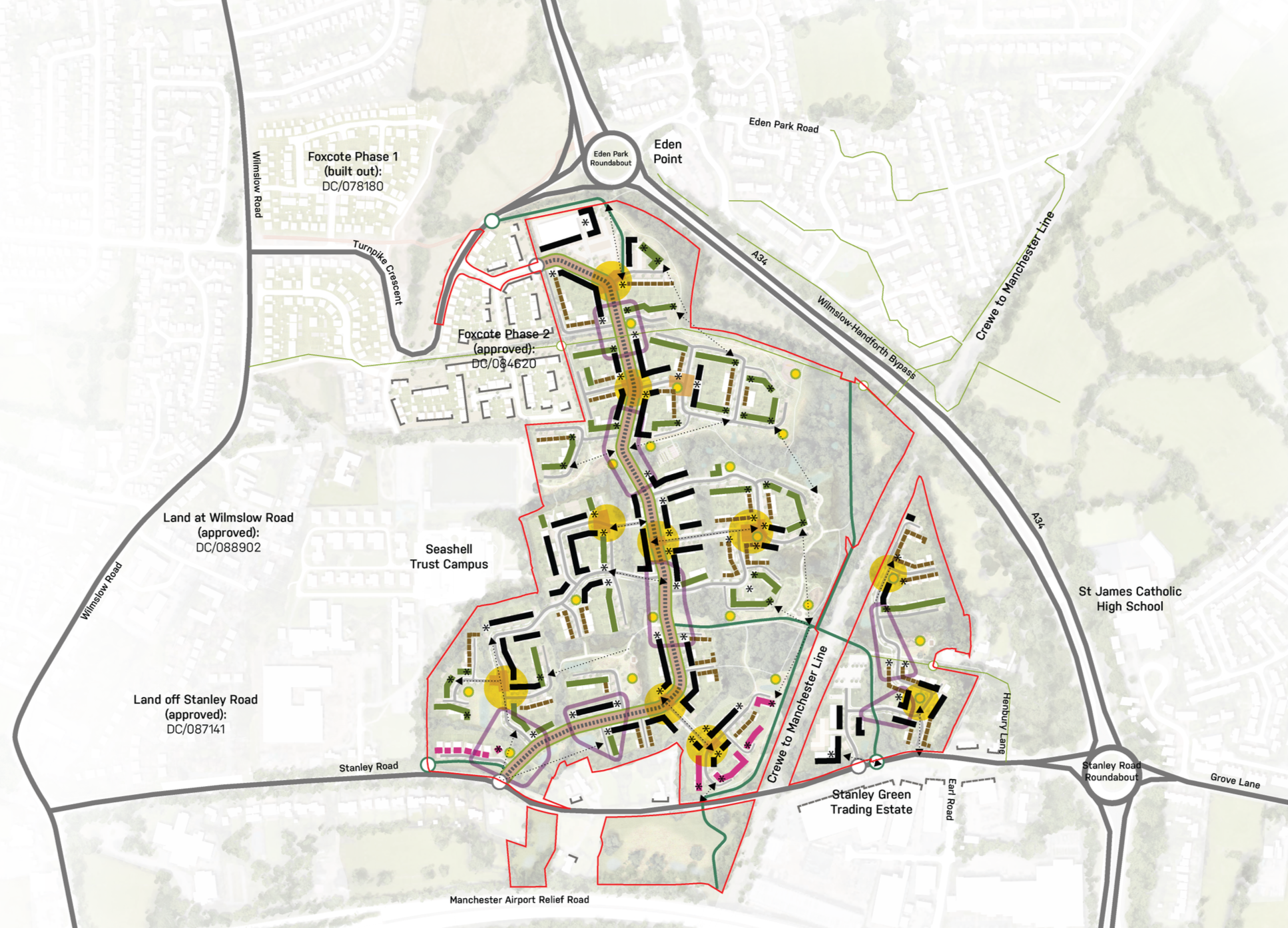
Map of a development area with street names, boundaries, and planning details, including roads like Wilmslow Road, Stanley Road, and the A34, with areas marked for phases of development and approved land use.

Key frontages and nodal points within the masterplan
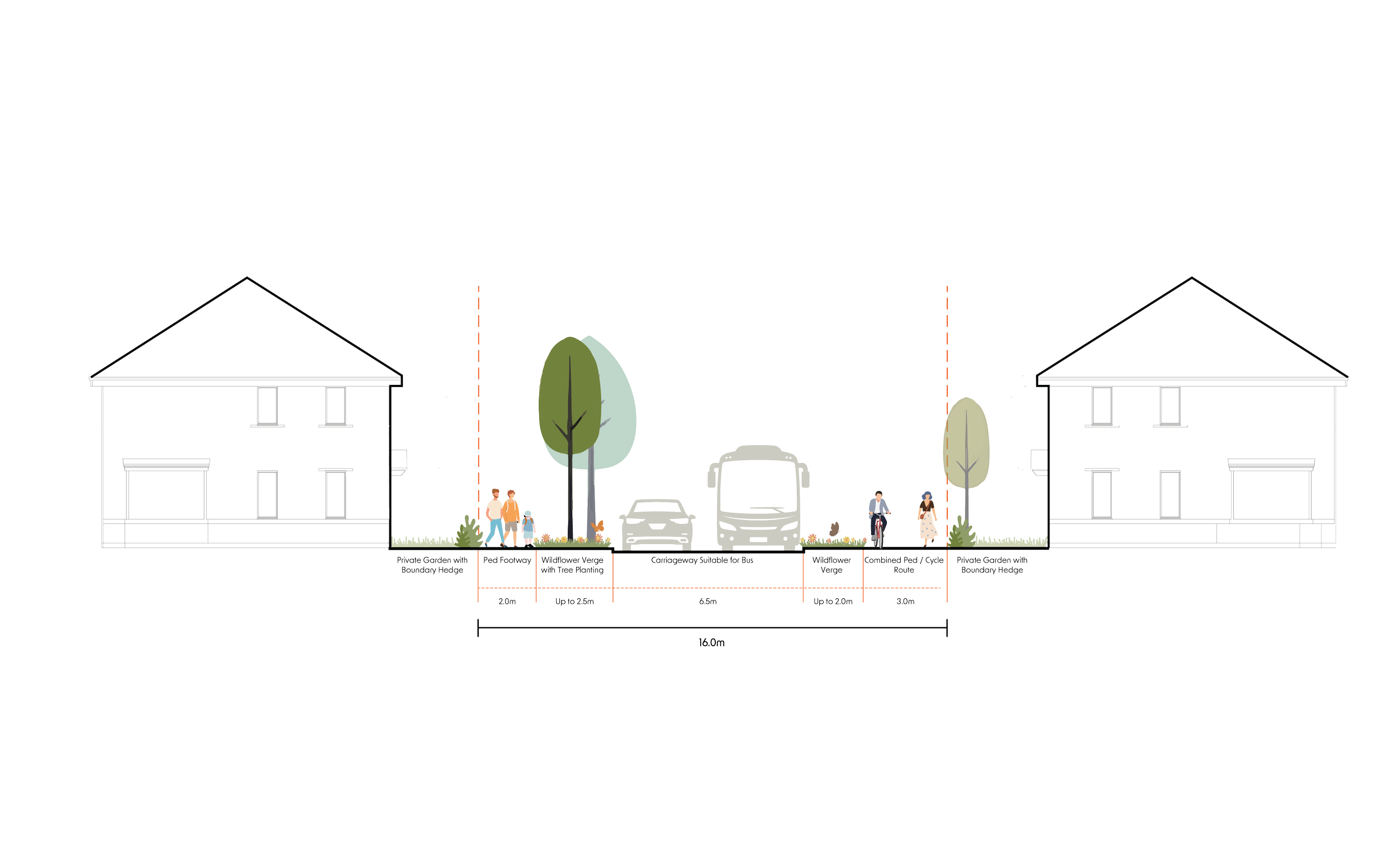
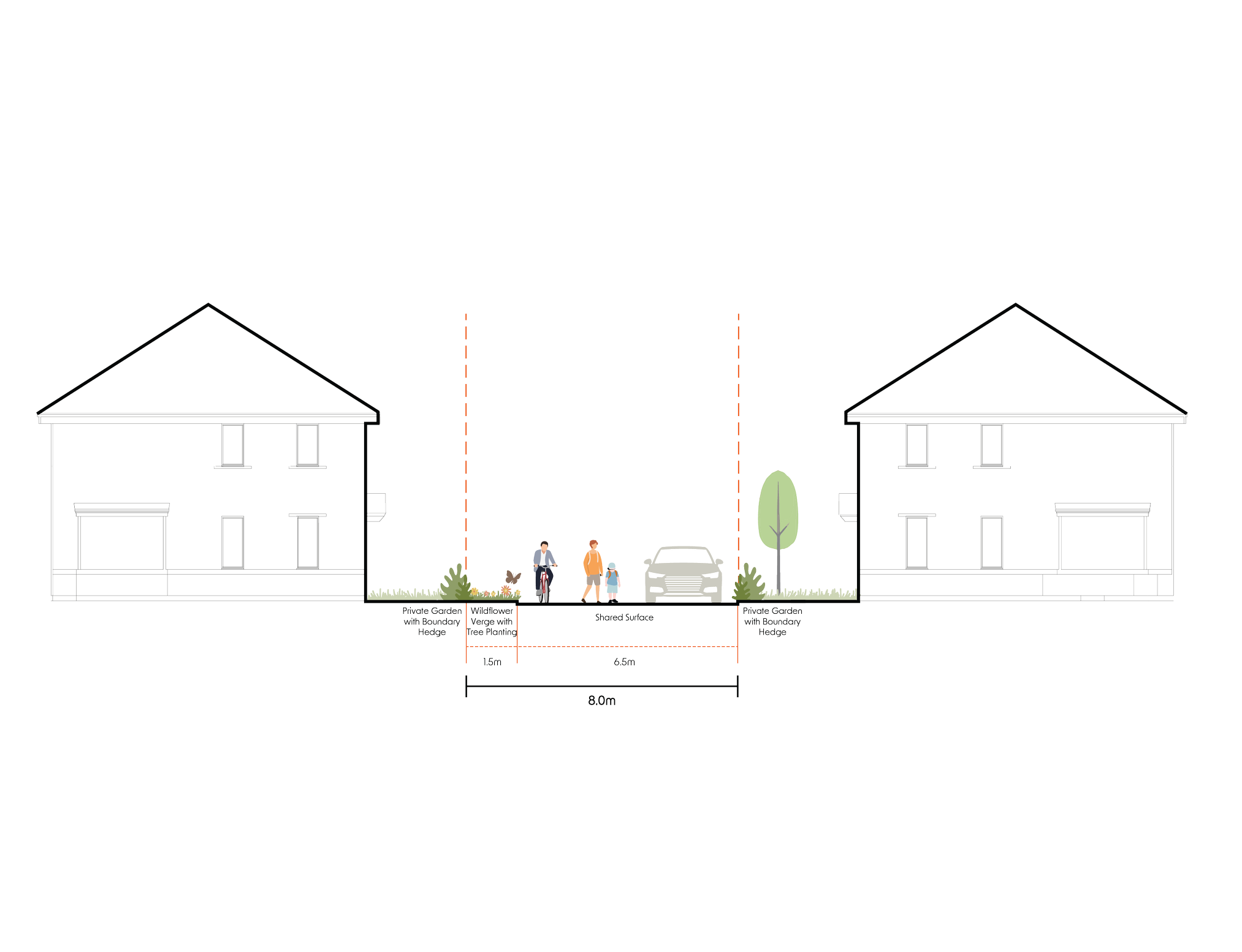
A detailed architectural plan of a neighborhood layout showing residential houses on each side, a central pedestrian and cycling pathway, trees, a bus-compatible carriageway, and designated spaces for private gardens. The plan includes measurements and labels for different sections such as pedestrian walkways, wildflower verges, and boundary hedges.

Avenue Street Type cross section

Cross-sectional diagram of a house with roof, rooms, and a red highlighted section showing different construction zones including wall, roof, and foundation.

Lanes Street Type cross section

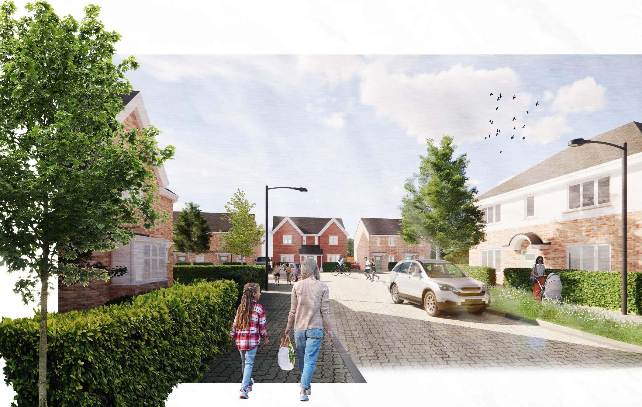
A neighborhood scene with brick houses, green trees, people walking and biking, a parked car, and street lamps under a partly cloudy sky with birds flying.

Illustrative view of typical street within the development

Client: Bloor Homes

Services: Masterplanning, Urban Design & Landscape Design

Collaborators: NJL Planning

You can go back to our project work here